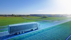
Robots, drones as well as unmanned aerial systems (UAS) will feature heavily during the DLG Field Days.
Field drones are quickly becoming efficient crop surveyors that could complement other sensing systems already in wider use, such as nitrogen sensors. Obvious benefits include cost reduction due to more precise application, the ability to integrate with different sensor systems and the possibility to significantly lower the environmental footprint of intensive crop production.
Field drones can provide extensive imagery of fields using high-resolution sensors to gather data. This enables farmers to improve crop yield by identifying zones of soil or crop differences, allowing them to adjust water use and only apply pesticides and fungicides when needed in specific zones and in the smallest amounts necessary.
Clever imagery can also calculate the vegetation indices for determining the biomass in a crop, weed distribution, soil properties and a whole list of other tasks.
The benefit of remote aerial imagery gathered by field drones is the ability to provide both the farmer and farm consultant with field and crop status information as often as desired, enabling more frequent and more accurate prescription adjustments to reduce input costs. By treating sites individually, yields are maximized and farmers can obtain accurate yield estimates throughout the growing season.
And this technology is not only useful for crop farmers - livestock producers also have the ability to use drones to locate animals over vast acreages, which is proving increasingly popular in the US. It is widely expected that within 10 years, the majority of farmers will be using some sort of drone on their farms, which is why the DLG has decided it pertinent to include a section on drones during its Field Days.
However, it is widely recognized that without good analysis of the imagery gathered from such technology, this mass of extra information may not fulfill its full potential, which is why so much research and development is currently taking place.
“It will be how these high resolution, geo-referenced NDVI and bio-mass aerial images are collated and presented to farmers and how they can be made to talk to other applications that will be crucial,” says Dr. Klaus Erdle, Smart Farming Manager, DLG.
“The great advantage of farm drones is the fact they can cover a large area and deliver a substantial amount of data that can be presented and analyzed in a relatively short period of time. The sensors themselves must, however, be small and light enough to be mounted on a drone. So there is a clever balance to be found,” adds Erdle.
Over the three days, visitors will have the chance to see and discuss a number of different types of drones and the applications they can be used for. The use of remote sensing systems will also be explored.