ACEINNA announces its INS1000 state-of-the-art, high performance dual band RTK INS (Real-Time Kinematic Inertial Navigation System) with built-in inertial sensors for construction, agriculture and automotive applications.
- Integrated navigation system consisting of inertial measurement unit (IMU) and other sensors
- Embeds ACEINNA’s 9 degree-of-freedom inertial sensor technology to achieve Automotive Dead Reckoning performance in GNSS challenged environments
- Dual frequency RTK and tight coupling between GNSS and inertial sensors provide centimeter-level accuracy, enhanced reliability, and superior performance during GNSS outages
- Delivers essential detailed position and heading accuracy
- Provides position, velocity and attitude information of vehicle
- Dual-frequency (L1/L2), dual-antenna GNSS receiver is used as primary aiding sensor
- Supports distance measurement indicator (DMI) attached to wheel of vehicle/robot to measure rotation rate of the wheel
- Integration of DMI gives improved solution in challenging environments such as urban canyons, tunnels, warehouses, and indoor facilities and campuses
- Horizontal position accuracy of 2 cm (RTK), vertical position accuracy of 3 cm (RTK), and velocity accuracies of 0.01m/s and 0.02m/s (horizontal and vertical, respectively)
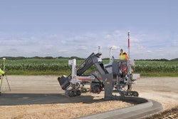
- Provides precision navigation capabilities required for automotive autonomous, automotive track testing, precision agriculture, and construction markets
- Compatible with all major global satellite systems (GPS, GLONASS, Beidou, Galileo, SBAS
- Supports USB, Ethernet, CAN and RS-232 interfaces
- Supports dual GNSS antennae for accurate heading in static and dynamic scenarios, and difficult magnetic environments
- Easy-to-use embedded software allows extensive configuration and diagnostic capabilities
- Enables configuration of output position, initialization of heading, IMU transformation matrix, GNSS antenna lever-arms, and NTRIP client
- Control software can log and decode output data from system or use web application to plot results on a map
Fill out the form below to request more information about ACEINNA INS1000 Dual Band RTK INS